|

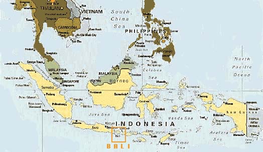
Map courtesy of the CIA
The Indonesian archipelago is made of over fourteen thousand
islands, with sizes ranging from a tiny speck on the map
to the island of Sumatera which is approximately the size
of the state of California. In fact, the island of Kalimantan
(or Borneo) is the second largest island in the world after
Greenland. The archipelago spans the body of water that
separates Asia and Australia.
The island of Bali is a small
island approximately in the middle of the southern part
of Indonesia, situated about halfway between Singapore on
the tip of South East Asian peninsula and Darwin on the
northwestern part of Australia. (It is the island directly
below the letter I of the name Indonesia in the map above.)
The archipelago can be divided into:
|


