if you prefer to see our old version site,
    please click here
distance
how far is it


This service uses data from the US Census and a supplementary list of cities around the world to find the latitude and longitude of two places, and then calculates the distance between them (as the crow flies). It also provides a map showing the two places, using the Xerox PARC Map Server.

Various query formats are allowed; for example:
Chicago, IL
Jakarta
40:26:26N 79:59:46W
Athens, Greece
From
to (optional)

or

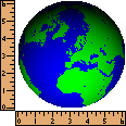
(Info on the image above.)


  visit our sister sites  


home | destinations | interests | indonesia | smart tips | members | art & crafts | featured hotel
featured article | news archives | about us | terms | vendors | advertisers | affiliates | contact us

developed, designed, and maintained by indo.com © 2000 AllRights Reserved